
Mancos
Your geology, right now.
How many times have you been in the field and wished you had a geologic map? With your iPhone or iPad, an internet connection, and Mancos, now you do. Go almost anywhere with GPS, a tap on the map, or search by name. Mancos shows you a geologic map of the area, details about the stratigraphic unit at that location, and the regional stratigraphic column, using data supplied by Macrostrat. You can even see all of the fossil collections reported in the region by the Paleobiology Database. The amount of detail is controlled by published geologic maps aggregated by Macrostrat; coverage is especially great in the United States and Canada. Mancos needs GPS and an internet connection.
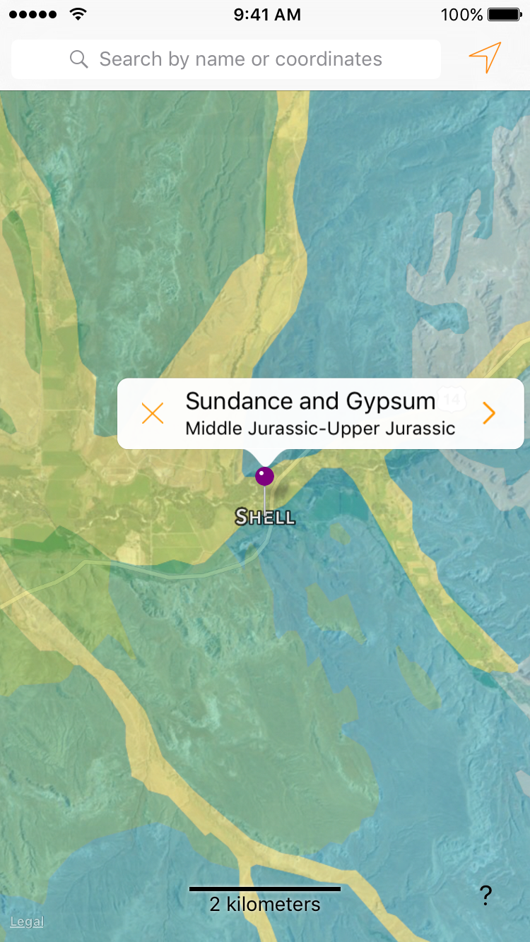
When you go to any place, you’ll see a geologic map and a pin that shows name and age of the stratigraphic unit at that spot. You can also tap on any other spot, use the GPS, or use the search to see the map and unit there. Tap the orange X on the label to just show the map.
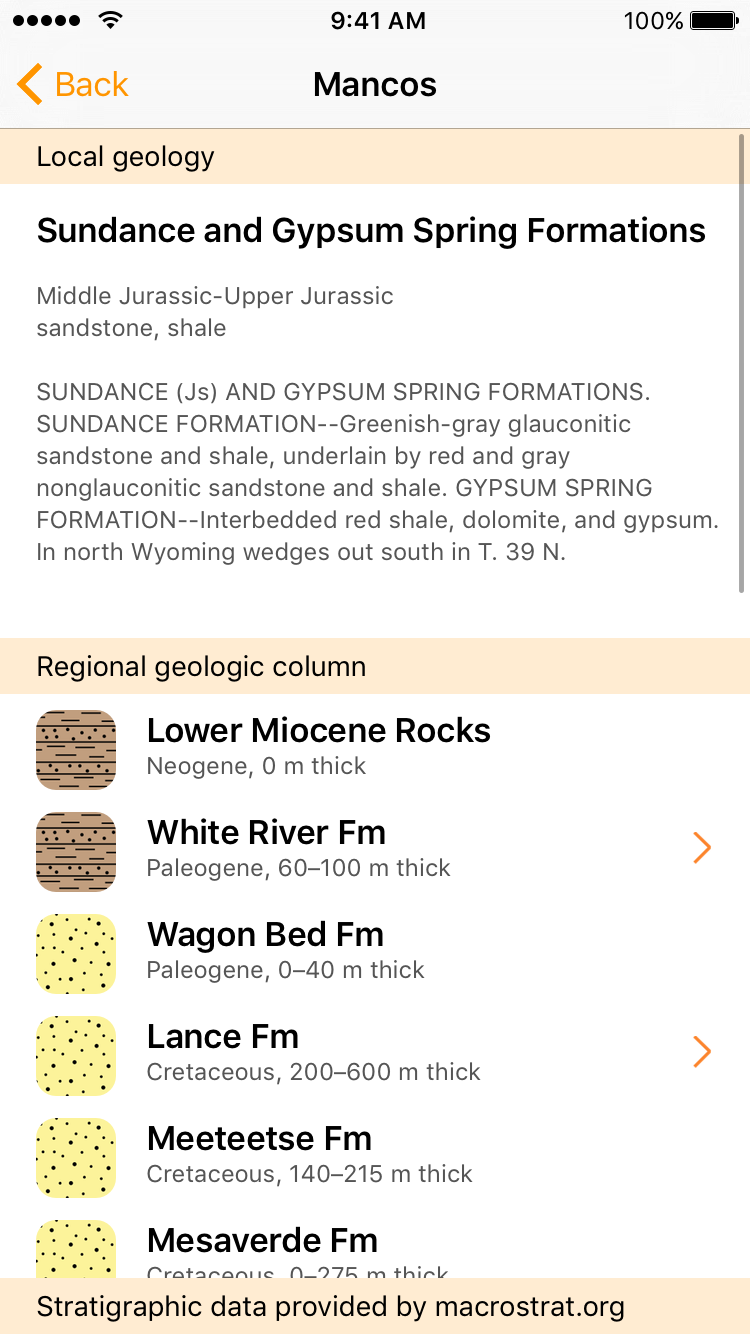
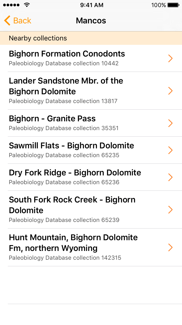
Tapping the orange arrow on the label shows you much more information about the local and regional geology. See the age, rock type, and description of the rocks around you, as well as a stratigraphic column for the entire region. If any of those units have fossil collections in the Paleobiology Database, you’ll see an arrow. Tap on it and you can see a list of those collections.
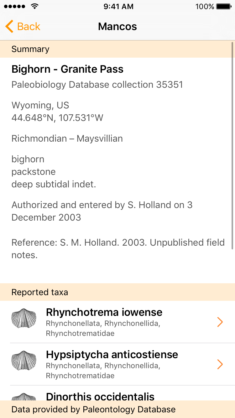
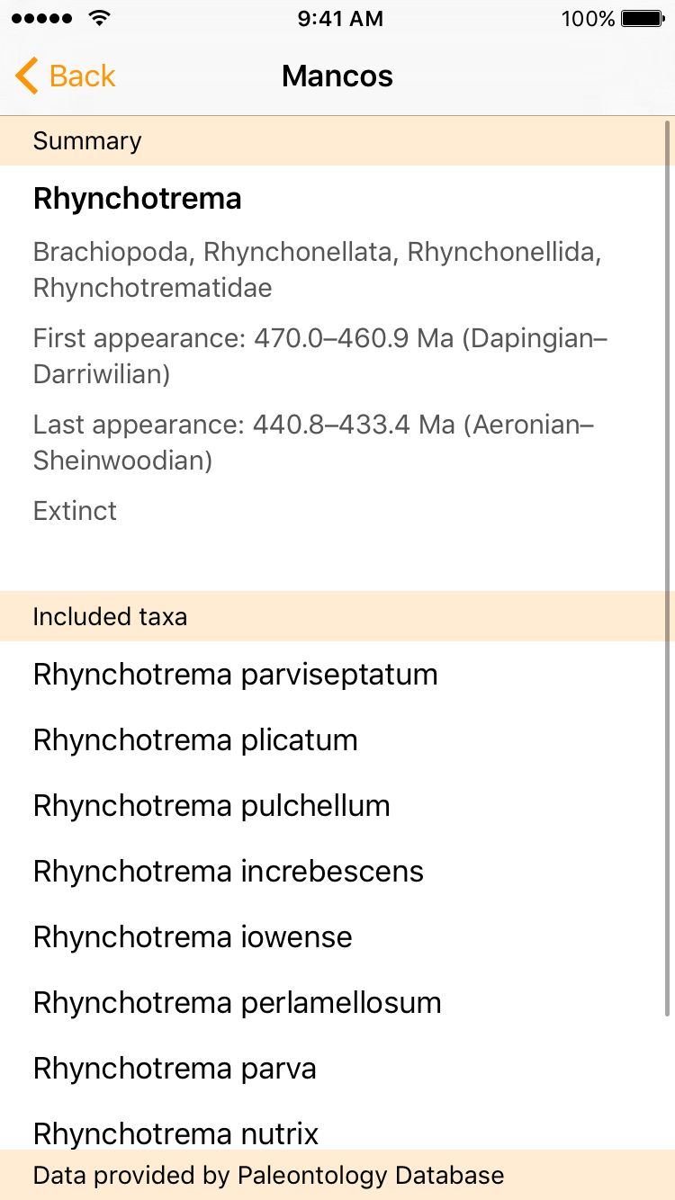
There’s more. Tap a fossil collection to see its details, including its location, age, and a list of species. Tap a species to see its classification, its first and last occurrence in the Paleobiology Database, and a list of its species.
Mancos is great for road trips. Turn on GPS tracking in the upper right of the screen, and Mancos will update your geology every half-mile. You’ll know the geology every step of the way, and you can even ask Mancos (in Settings) to speak the geology as you go!
Mancos also works on your Apple Watch.
Screenshots